Splitboarding the Three Saints in a Day (Gorgonio, Jacinto, Baldy)

On a good snow year, the Southern California backcountry riding possibilities are endless. They encompass plenty of steep terrain, relatively easy access (when Caltrans decides to plow), and countless peaks that can yield a few thousand feet of downhill sliding when the snowline gets down to say 5,000ft. But in the years I’ve lived in Los Angeles (2012 - 2023), that has happened very rarely. During drought years, the options dwindle. Those of us who are sufficiently addicted to snow are left scratching out turns on icy north faces in the lower mountains or seeking out higher quality snow in the biggest terrain we have within a two hour drive of Los Angeles: San Gorgonio, San Jacinto, and San Antonio (Mt. Baldy). These “three saints” are the highest peaks in their respective local ranges: the San Bernardinos, the San Jacintos, and the San Gabriels, all protruding more than 10,000ft above sea level. When it rains down low in the valleys, we wait for the skies to clear so we can raise our eyes to the local giants to see how far down their flanks the glistening white blanket will reach. Then we hastily pull up the weather forecast to see how quickly the famous Southern California sunshine will make it recede.
Despite the ever-present lack of snow, 2015 - 2020 was a golden age of winter backcountry adventure for me in Southern California. I was lucky enough to meet some people who held my same passion to explore the mountains in the winter, optimistically searching for decent skiing and riding (yes, I often associate with two-plankers, sue me!) anywhere we could think to look for it. These fellow addicts not only shared my motivation and ambition to ride, but also were experienced backcountry travelers well versed in avalanche safety, had a similar fitness level, a similar tolerance for risk and physical suffering, and most importantly personalities that made the long hours in cars and in the mountains fly pleasantly by. In short, they were not only competent partners to whom I regularly trusted my life, but also good friends. Together we rode many mountains near and far, and the three saints were favorites in the local rotation.
But in 2020 everything changed. The world collapsed in on itself. People were dying. Everyone closed ranks. Only “essential” relationships could be maintained. Those of us with mountain addictions found ourselves in a relatively lucky position. The ranges we loved seemed to be the only safe places to recreate, and gave us an opportunity to socialize “normally”. But LA is no place to be if you’re a snow addict and unemployed, or if you can work from the comfort of your laptop. One by one, my crew of partners dispersed to be closer to their preferred mountains: Idaho, Montana, Mammoth, Tahoe. But I was still in LA. I was lucky enough to have steady work at my day job, a post-production audio facility in Burbank. I was still going into the office, working from a dark windowless room, mostly alone like I had done for the last 8 years. And still as addicted to the snow and the mountains as ever.
The three saints link-up is a common Southern California summer challenge for hardcore hikers looking to tackle the three biggest mountains in the region in under twenty four hours. No small feat, it holds about 11,500ft of ascent and descent, with over an hour of driving between each trailhead that eats into precious hiking time. While the summer mission never held much appeal for me, I was always curious about doing it in the winter when one could replace a long walk down each mountain with fun-filled snow sliding, and I had never heard of anyone doing it this way before. I had pitched the three saints as a winter touring link up to several of my partners over the years, never with much traction. It’s more of an endurance challenge than a tick list item, and most of them would rather seek out new objectives farther afield than to connect the old favorites. I had never attempted it in previous years due to high snow lines lengthening the walk on approaches and exits, and therefore slowing down the whole process. But in February 2023, I found myself with a free weekend on a big snow year, with no local partners to call, and thought I might as well just go for it solo. After all, I had ridden all the lines multiple times, knew the routes like the back of my hand, and expected the avalanche danger to be extremely low given how firm conditions had been lately. So what the hell.
I left my house in Montecito Heights at around 6:30pm on Friday, February 3rd to join the herds fleeing Los Angeles to the east on the I-210 freeway. My plan was to head to the South Fork trailhead on the north side of Gorgonio, sleep in my very comfortable van, and start the mission at 3 or 4am to be riding the north face of Gorgonio at first light. When I arrived around 9:30pm however, the night was warm and still, the skies clear, and the moon nearly full, bathing the burned out forest in a haunting glow. This area burned in the 2015 Lake Fire, which allowed the needle-less trees to let enough light through that I could see perfectly well without a headlamp. The snow at the trailhead was a bit patchy, so I got out of the van to stretch my legs and preview the first bit of trail to see how quickly I’d hit consistent snow. After about a hundred yards, I found it. I stopped and examined the position of the moon in the still night air. Plenty of light left. Might as well start now. So back to the car I went to get my gear ready: a few bars, water, layers, and what always seems like a silly number of pointy metal tools. But since they don’t do any good when they’re left sitting in the car, they went into the pack. Twenty minutes later, I was skinning my splitboard through the South Fork burn zone by moonlight.
That night was special. The snow improved as I gained elevation, from a thin crust over a shifting, sugary, near-ground facet layer, to a dust on supportable crust situation, with two or three inches of wind deposited powder. The blackened trunks of the burn gave way to un-scorched old growth under Mt. Charlton, and the gnarled branches gave the moon-shadows new dimension.
Old Growth moon shadows.
As I gained the bench beneath the northwest face of Gorgonio, a shimmering luminosity caught my eye high in the cirque to the southwest below the summit of Mt. Jepson. I thought it might be the distant glow of a headlamp on the snow, that there might be somebody as daft as I was traipsing around in the middle of the night. But it was far too widespread to be from a single earthly source. After a moment, I realized it was the moon reflecting on the cirque's icy spines. I’d never seen anything like it before. It was beautiful, but also made me concerned for the quality of the riding to come.

Stars and moonlight reflected high on the Jepson Cirque.
As the angle of the northwest face began to steepen, the snow quality began to deteriorate. Ice balls, windboard, and avalanche debris dominated the lower flanks of the face. I switched to split crampons and hugged the rib between two of the three northwest gullies to stay out of the heinously textured gut, but the snow wasn’t a whole lot better. The ride down was going to suck, but silver lining, the whole thing had already slid and certainly wouldn’t again tonight. To boot, the wind, which had been undetectable 500ft below, was making its grand entrance, hammering me at a steady 35mph. It was 2am and my hands were getting cold even through my windproof gloves. I guess I’ll wear something thicker the next time I tour in the dead of night.
But on I soldiered, making my way up ice and windboard to the summit ridge, which was basically a rough hewn skating rink. It was beautiful under the bright moon, but treacherously slick. I slipped and skated my way to the true summit across the rolling ridge. As I reached the top, the wind continued its assault on my face and hands, and I quickly prepared to descend. After 6.5 miles and 4,500ft of elevation gain I had reached the first and highest of my three saint summits.

The summit ridge of San Gorgonio: moonlight on ice and the city lights glowing below.
A windy San G Summit.
I spared only a few glances at the city lights of the Inland Empire far below, like smoldering embers dispersed by the wind that pelted me.. I ditched my split crampons in my pack and skittered in split mode with skins on back down through the icy ups and downs, less than gracefully I’m sure. The skins gave me the modicum of control I needed to traverse back to the northwest face without incurring the indignation and pain of a bruised tailbone. I ripped skins and transitioned my board to ride mode on the false summit above the northwest face, put my headlamp on for the first time that night, and aimed for the lowest angle of the three chutes. It was barely edge-able. Clear ice, and coral reef windboard led to the foot high step down of an avalanche crown, below which lay a bullet proof bed surface with the occasional rock rearing its head. After 800ft or so of careful turns and much side-slipping with ice axe firmly in hand, the dust covered enough of the crust to properly ride. Another 2,500ft of fun low angle turns brought me back to the traversing South Fork trail, and I went back to split mode to snowline.
Some decent riding, if not videography, below treeline.
At 5am, I was back at the van, driving down the hill to get cell service for a check-in text message to my wife and a well deserved nap before heading to San Jacinto.
Hot takes on San Gorgonio after zero hours of sleep.
Tired and a bit loopy from lack of sleep, I pulled over around 5:30am at the first sign of cell service, got the word out that I was ok after San G, and passed out without knowing exactly where I was. My alarm was set for 6:45am, so I could knock out the hour drive to the Palm Springs Aerial Tramway and catch the first tram up to Long Valley (elevation 8,400ft) at 8am. When it went off, I realized I was just outside of Oak Glen: a magical land in the foothills of the San Bernardino mountains of apple orchards, cider mills, and good old-fashioned fall family fun. This Southern California town is one of the few that stirs me to practice some of the long held (albeit somewhat cliche) traditions of my Midwestern roots, like pumpkin picking, corn mazes and bobbing for apples. I try to make a trip there every fall. But today wasn’t about the cozy comforts of apple pie and mulled cider. Today was about doing some significant suffering in the winter high country, with two more mountains ahead of me to ride.
That being said, I may have caved and hit snooze on my alarm once or twice, but I was able to get moving by 7am or so, drive to the base of the tram in Palm Springs, and make the second or third cable car up the mountain. Though I was tired from my night on Gorgonio, the rays of sun shining through the desert valley and onto the flanks of San Jacinto helped give me a fresh bout of energy and stoke. My legs felt good on the walk out of the tram station and down the ramp to the Long Valley ranger hut, and I felt ready to put skins back on snow for another 3,000ft of vertical.
My sights were set on the east face of San Jacinto, the mellowest line among the three saints. The winter approach is 3 miles, consisting mostly of low angle drainage skinning until it steepens to around 30 degrees on the face above Tamarack Valley. Not to say that other parts of the mountain don’t have some serious terrain on them. Snow Creek is a couloir that drops down San J’s precipitous northern drainage a full 10,000ft to the desert floor. The bottom half of that rarely, if ever, fills with enough snow to ride, so enjoy a few thousand feet of bushwhacking with your skis or board on your back, while the top boasts a spicy 50 degree exposed entrance where conditions can be hard to assess. I had made an attempt to ride the line a few years earlier, only to find blue ice under unstable snow, and settled for a repeat of the east face instead. I would make another attempt at it the spring after my three saints adventure with a much more successful result, though not without a few more harrowing moments. 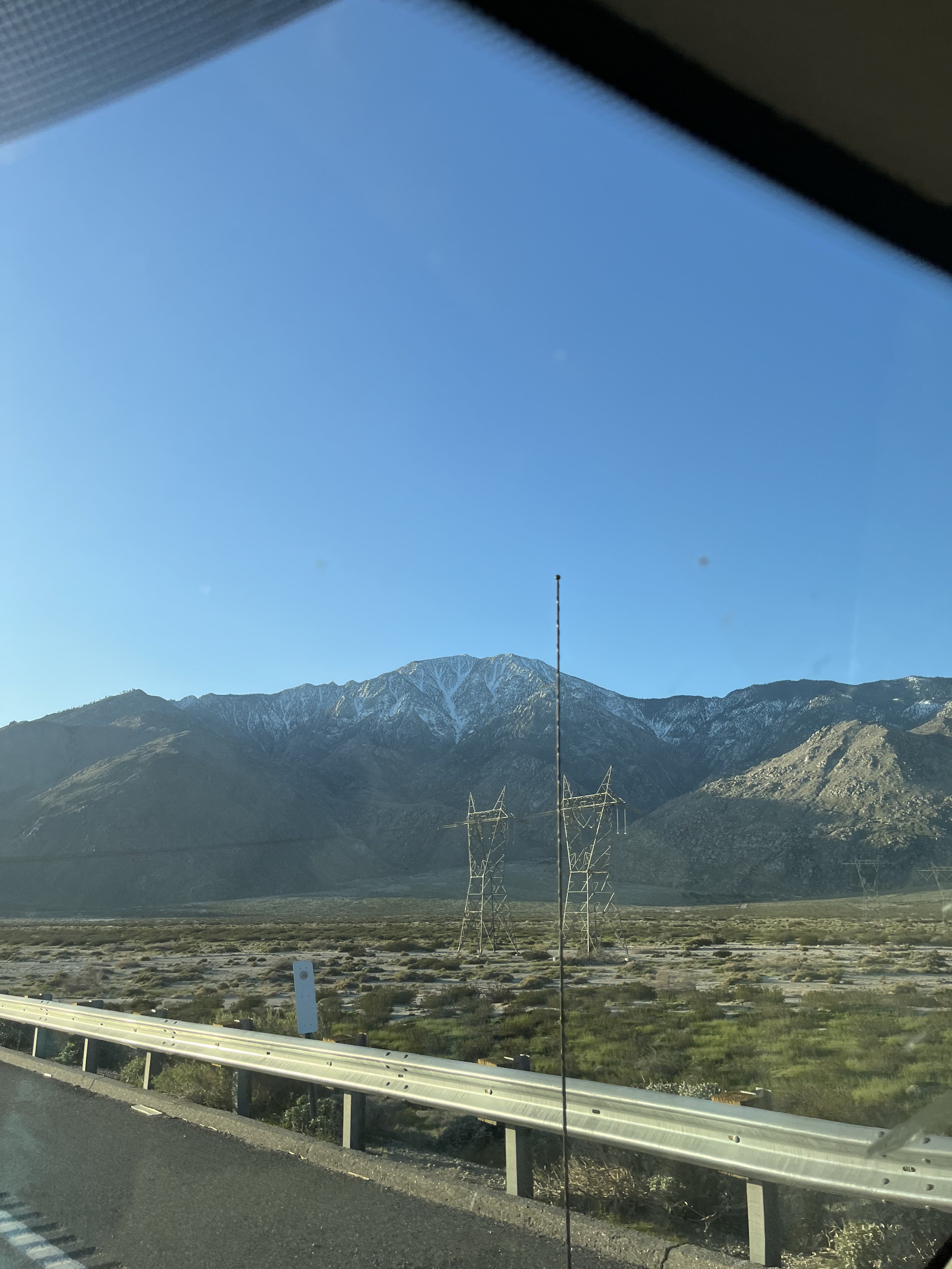
Looking up at Snow Creek and saving it for another day
In contrast, my days of riding the east face have been low stakes, and downright FUN! The tram makes the effort level relatively minor, the slope angle isn’t high enough to have much in the way of stability issues, the aspect collects beautiful wind deposit, and the scattered old growth trees and granite boulders make for an enjoyable, playful downhill experience. So as I skinned upward out of Long Valley, I looked forward to a little respite of recreative soul-boarding before heading to race the sunset in a lap on Mt. Baldy.
The sun, however, had other plans. It was strong that morning and everywhere it shone on the east facing slopes the snow became wet and sticky. I skinned from tree shadow to tree shadow in the old growth down low, hoping to keep the glopping on my feet to a minimum. But by the time I broke out onto the sun exposed east face, my skins were already picking up chunks of soggy snow, and my legs began to drag from the extra weight and the 7,000ft of elevation I’d climbed since setting off for Gorgonio. Luckily, I was early enough that the glop hadn’t penetrated too deeply into the snowpack, and the relatively mellow slope angle too assuaged any potential avalanche concerns. So I was left with my stubbornness to wage war against my heavy feet and tired legs.
Eventually, stubbornness prevailed and I made it to the summit ridge where the snow was holding its structure a little better. At 10:45am, two hours after I left the tram at Long Valley, I topped out on the San Jacinto summit. I felt good about my pace, given how much effort the last bit of the climb had required, and even had some hope that the powerful sun would keep the south-facing bowl on Mt. Baldy soft enough that I might have some decent riding there around dusk. After a quick snack and transition back to downhill mode, I was gliding through mushy snow, which by the way is much more fun on a snowboard than it is on skis, back down the east face, through the glades of Tamarack Valley and the creek bed below, which had more snow in it than I’d ever ridden there before. Rock features that used to force traverses away from the creek now provided fun pops and drops all the way back to the flats of Long Valley. After the ride, an unwelcome steep walk back up the ramp to the tram, and a respectful glance of reminiscence back at the summit, I took the next tram down to Palm Springs for yet another chunk of driving to Manker Flat, where I would start tackling my third and final saint.
Fun, slush riding on San Jacinto’s east face.
I arrived at Manker Flat around 2:15pm, a little stiff in the legs from sitting in the car for an hour and a half, and still a little wet from all the warm snow on Jacinto. But I’d been stiff and wet before, and had trudged up Baldy more times than I could remember. So after a little stroll around the parking area to stretch the legs, I threw my board on my pack and both onto my somewhat annoyed back to begin the familiar march.The Ski Hut trail from Manker to Baldy Bowl starts on the paved road to San Antonio Falls. The blacktop here rarely holds snow for very long after a storm, and after a switchback and a turnoff onto trail proper, the route side-hills across the steep terrain of San Antonio Canyon all the way to the Sierra Club’s iconic green ski hut. With the traversing nature and patchy snow, I’m usually inclined to walk this section, as I was this day. I trudged upwards following the consistent trench of the many pairs of mountaineering boots that had traveled this way since the last significant snow. Many of these boots were coming down the mountain now, their owners excited at their conquest of what is almost every Southern Californian’s winter mountaineering introduction: the Baldy Bowl. Known for its many accidents due mostly to the sheer number of climbers going up it on any given weekend, it is an east to south facing cirque that tops out just shy of the 10,000ft Baldy summit. It houses a number of steep chutes on one side and a couple of wider faces on the other, a little something for everyone who wants to try their hand (and feet) at climbing some snow with an ice axe and crampons. Conditions here can be unpredictable for the average Los Angeles local. The mountain sports a jaunty cap of slick, icy snowpack in the winter even when the sun shines with 70 degree heat in the valley below. People make the mistake of thinking winters are mild here, when in fact they are vicious, and occasionally deadly.
Hence the concerned looks that I noticed on more than one of the faces that passed me on their way down the mountain. I sympathized with their concern. After all, it had been a hot day, and they had all started very early to make sure the snow was firm enough to allow them safe passage up and down the mountain. Unlike the east face of San J, the slope angle here is very much steep enough to have stability concerns, and many chutes in the Bowl regularly do avalanche with rapid warming. I had more than once muttered under my breath about the poor judgment of people going up the mountain too late on a hot day, clearly unconcerned about the very real avalanche danger that was regularly at the forefront of my mind. But as I looked at the upper mountain, I could see that the Bowl was now moving quickly into the shade, and knew that a warm snowpack would not be a likely issue.
As I climbed to the hut, I remembered a trip I took with my wife there only a month before. She too was one of the many LA natives who had very little to do with snow, but who had bravely taken on her own three saints project of summiting San Gorgonio, San Jacinto, and San Antonio in winter conditions. Having already tackled the first two the previous spring, it was time to see what Baldy was like at 10,000ft in the snow. The conditions were firm that day, ideal for crampons actually. But on our way down we ran into a group providing medical attention to a woman who, lacking crampons, an ice axe, and a helmet, fell hundreds feet down the Bowl, hitting several rocks and trees in the process. We assisted in carrying her rescue litter to the Ski Hut, where she succumbed to her injuries shortly after. I’ve never seen somebody’s skin look as gray as hers did while a medical professional performed CPR on her to no avail.
Conditions were not so different on this day. The sun was dropping low in the west, and its rays had abandoned the Bowl all together. The snow that had been baking just a couple of hours before had already formed a slick, firm surface that would continue to set until the next morning’s sun started the melt freeze cycle all over again, the key ingredient for California’s legendary corn snow. But this evening, I made sure to don my split crampons as I transitioned yet again to skins, and headed up the flank of the ridge across the Bowl from the Ski Hut that would skirt the steepest terrain and take me safely to the summit. I was solo, and not at all interested in becoming another statistic.

San Gorgonio to the left and San Jacinto to the right in the distance from ridgeline on Baldy.
I worked my way north, across the ridge to the top of the Bowl. With the sun getting lower, the sky had taken on brilliant hues of orange and gold. On the final push to the summit I felt the day’s 11,000ft of vertical catching up to me. Every step was harder than the last, but I knew I had it in the bag if I put it in low gear and just kept chugging upward. I was again rewarded for my stubbornness with an incredible view of the sun putting on a fireworks show as it set in the west, with a full moon rising in the east above the extended shadow of Mt. Baldy itself. The wind howled around me but I ignored it and took my time drinking in the views. At 5:30pm, almost 20 hours and 30 miles of walking after I’d started, I’d topped out on the third of Southern California’s three saints.Sunset on Baldy’s Summit.

Preparing to ride the bowl, looking out to the endless terrain of the Cucamonga wilderness.
The ride down to the Ski Hut was absolutely horrendous. I had missed the last of the corn by about two hours, and the entire slope of the Bowl was set up like concrete in the evening refreeze. But I picked my way down it carefully, scratching out turn after turn, willing my legs to continue to hold my weight over my edge for another 2,000ft of riding. I made it to the Ski Hut as dusk fell, and ran into two climbers planning to snow camp for the night on the ridge. I mentioned the wind, and told them the story of my day. I was glad to have someone to share my accomplishment with, if only a couple of complete strangers. I’m writing this now because I’m glad to share it with more strangers in the hopes it will inspire one or two of them to get out and get after something they’re not sure whether they can accomplish or not.Final thoughts on the walk back to the car.
I reached Manker Flat and the van at about 6:45pm, 21 hours after I started. That stopped the clock, and ended the adventure for me. I was glad of it. As excited as I was to have fostered this idea over several years from conception to execution, to have tested myself physically and mentally against the goal, to have changed who I am and what I know I’m capable of by tackling this mission, I was now far more excited by the prospect of going home. Instead of praying to the saints for snow, I now prayed for a shower. Instead of asking for safe passage through the mountains, I asked them to guide me back through the city’s interstate arteries and into my own bed. And for once, a day without any mountains or riding tomorrow.


Leave a comment