If you are looking for cascading streams through a shaded canopy of flourishing vegetation within a short drive from the city, the Ice House Canyon trail offers more bang for your buck than almost anywhere in the entire Angeles National Forest. Beyond the short nature walk through the trees is a Peak Bagger's paradise with some of the tallest mountains the San Gabriel range has to offer. Although most well known routes to these peaks are steep and tedious, none of them offer the seclusion or adventure brought on by Falling Rock canyon.
The class 2 gully extends from the south side of the Icehouse Canyon all the way up to the heights of the Ontario Peak trail, ascending 3,900 feet in 2.6 miles as it passes two tiers of mostly dry falls, loose boulders, talus, and a massive scree field. These physical difficulties only slightly overshadow the demand for a strong navigational prowess since wandering in the wrong direction can easily place its traveler on some very dangerous terrain.
DISCLAIMER
There are a handful of cross country hikes here in California's vastwilderness that push the limits of the word "adventure" for several reasons. They are extremely remote locations that most people will never have the pleasure of seeing. A consequence of their isolated location is that rescue is highly unlikely in the case of an emergency.
That being said, it is the responsibility of the few that are capable of reaching these locations to practice safety when traveling to these places.
Double and triple check your supplies (especially water).
Check weather conditions the morning of your hike before you lose cell service.
TRVRS Outdoors is all for encouraging new and exciting adventures, but part of the adventure is doing adequate research ahead of time to assure a safe and fun trip which is why we've decided to document these back country hikes. Stay safe!
Google Earth Overview of Falling Rock Canyon route to Ontario Peak, Cucamonga Wilderness.
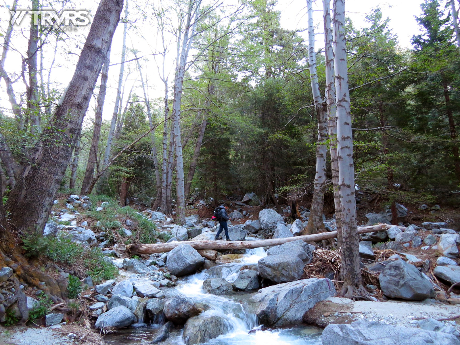
Icehouse Canyon
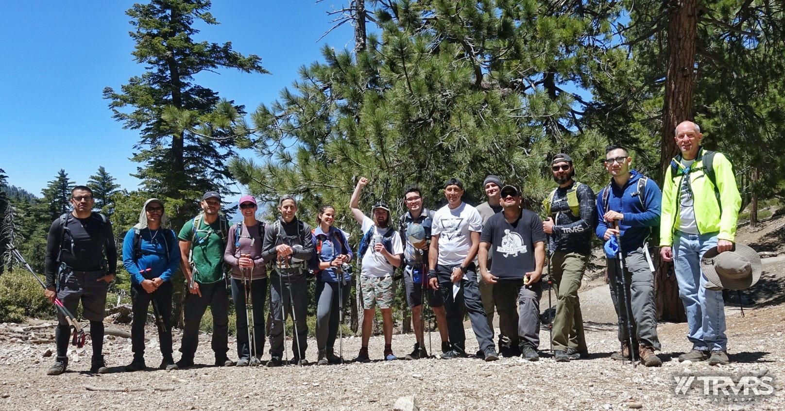
May 5th 2019 -- 6:00 AM. Fifteen people met in the Icehouse Canyon trail parking area to ascend FRC (Falling Rock Canyon) as a course preview for the 2019 Fool's Traverse. An early start time promised minimal parking issues at one of the most heavily trafficked trail heads in all of Southern California. After a short description of what to expect along the outing, fourteen of us made for the trail, while one (Justin) waited for his friend to arrive. We would maintain radio communication with Justin as we ascended.
Ten minutes of walking brought us to a small footbridge and eventually the first switchback of the Icehouse Canyon trail. It is at this switchback where the route to FRC veers southeast to cross the creek. I stepped off of the main path to see how much of a spread we had and the group was marching single file right behind me. It was panning out to be a strong effort out in the mountains this day.
Photo of Icehouse Canyon by Justin Williams.
Entering Falling Rock Canyon
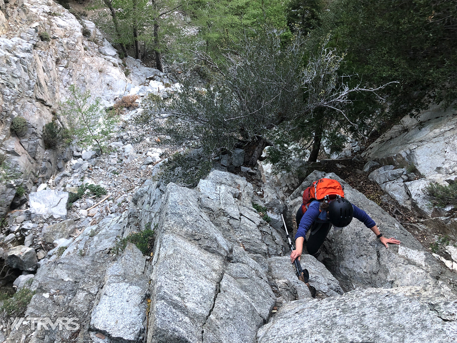
We continued along the mostly obscure use trail shrouded in stringing nettle and poison oak, before crossing the creek. The south side of the creek is heavily forested and any sort of path was mostly lost, but continuing southeast and veering steadily south placed us at a clearing in the trees where we could see the mouth of the canyon. As we navigated the small boulders, the route became continuously steeper and eventually we reached the first tier of falls where the entire group put on their helmets. The extra gear wouldn't have been critical to this route in a smaller group with good communication, but in a large group setting with different experience levels, it made more sense to require them.
Lauren Decker, ascending the small chute near the dry falls.
While a confident climber could definitely ascend both tiers of the falls directly in dry conditions, we opted for a loose dirt path and small chute to the left. Eventually everyone made it up this short but difficult section we'll call the lower falls, and the spread had now reached about a quarter mile. The remainder of the canyon up to Sugarloaf saddle would include nearly 1,200 feet of vertical gain in just over half a mile scrambling over large boulders and loose talus. The important thing to note is that although there are a couple of offshoot gullies along the route, we would stay in the main canyon until we reached a large rectangular boulder center right of the path followed by a huge downed tree log. To the right of these land marks is the scree field we would ascend. If you end up clenching for dear life as you ascend a near vertical wall, you most definitely have turned too early (not spoken from any sort of experience).
Rectangular boulder and tree log near scree field. A great land mark to know when to leave the canyon. This photo taken on another outing.
Ascending Sugarloaf Saddle
As we reached the scree field, I could see that a few of the front runners started ascending too far to the right which was dominated by tiny pebbles, making it near impossible for them to gain any traction (this side should be reserved for descending). We continued further to the left where we were able to bypass at least 100 feet of scree for more stable dirt switchbacks, and eventually talus.
Eventually we made it up to Sugarloaf Saddle, where we waited for the rest of the group before opting for Sugarloaf Peak. The route is fairly obvious although still unmaintained by any means. We would follow the ridge North until reaching a plateau (about 300 yards with 150 feet vertical gain from the saddle), then continue west where we arrived at the peak. Atop Sugarloaf Peak, the Mount Baldy village was a small spec that indicated some good progress, while more humbling was the massive climb that was now completely visible just south. Most of the group talked about how close it looked and I knew better than to agree with those kinds of kinds of remarks.
After regrouping at the saddle, we received radio communication from Justin and Cisco who had accidentally passed the scree field and began an ascent along a 25 foot tier water fall. He asked for tips on the route but I had never climbed to that point. I suggested moving toward the ridgeline to avoid any further unknowns and we lost radio contact. This would be the fifth or sixth time I've heard of friends under or overestimating the point where you leave the canyon.
The Ridgeline to Ontario Peak
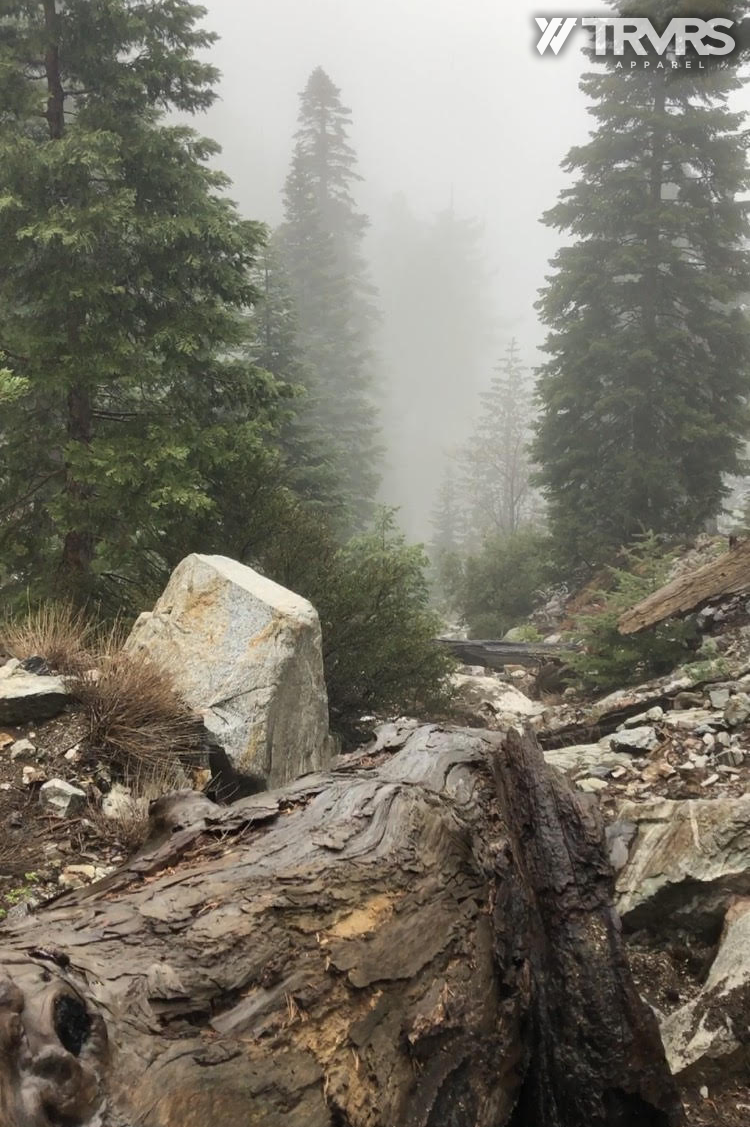
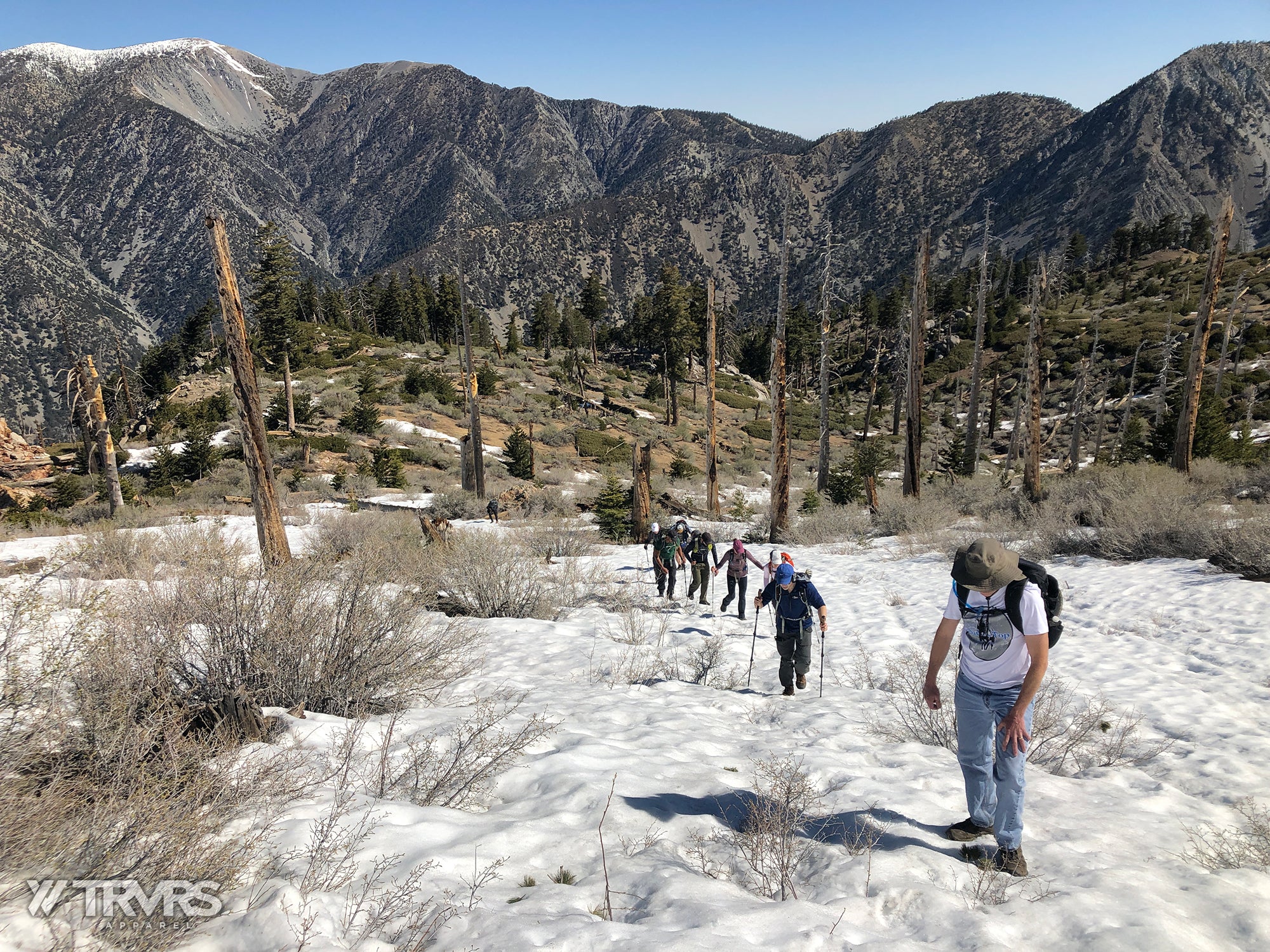
The rest of the group began following the sporadic path that meanders along the ridge often rerouting due to fallen trees or overgrown Manzanita. We would continue to climb nearly 1,500 vertical feet in just over 3/4 of a mile before reaching a shaded plateau that hinted at the epic views of Ontario Peak. A quick break allowed for the back of the pack to catch up and before the group got too comfortable, we made for the last 1/2 mile and 600 feet. A thin layer of snow highlighted the route which for the most part continued directly south from the treeline staying near the apex of the slope. We often stayed atop fallen trees to avoid wet feet and slipping.
Nearing the Ontario Peak trail.
Finally we reached the highest point in they day, Ontario Peak. The group took a long break to refuel. Cool winds and warm sun left us feeling refreshed while taking in the views of Los Angeles blanketed in clouds. Just as we started to gather our belongings, Justin radioed in. He and Francisco had made it back onto the ridge and were nearing the peak. Most everyone was out of beer so we opted to then split into two groups. While Jeremy would lead the bulk of the group to Big Horn peak for some more cross country action, I would hang back and wait for the others to catch up...and open up my secret bonus tall boy, *crack, fiiizzzzz*...
Our group took the Ontario peak trail down to Kelly Camp and made it for the tail end of a short break the others were taking at Icehouse Saddle. They described the route from Big Horn as fairly easy to navigate besides a few bits with heavy brush. As I recall, the route moves North from the Peak and then veers northeast into a mild gully before hugging right side of the gully and rounding directly into the saddle. We took a quick group photo and slowly but surely started heading toward the trail head. Everyone seemed to depart with a new confidence, even if a few were confident that they would never do that again!
MORE INFO (not including Big Horn Peak ascent)
Total Distance: 10 miles (not including Big Horn Peak ascent)
Total Elevation/Loss (feet): +4,100 ft / -4,100 ft
Easy class 1 trail before crossing the creek (first half mile)
Use trail beyond creek disappears and steep loose rock terrain emerges for remainder of canyon ascent (1,500 ft vertical gain in 3/4 of a mile).
More route finding near sugarloaf saddle, but terrain eases.
Mild (avoidable) bushwhacking along the entirety of the ridge.
Class 1 near Ontario peak and back to Icehouse Saddle.
Use trail up to Big Horn Peak with faint animal trail along North Slope (direct route to Icehouse Saddle).
***If you are planning to complete this hike, please be aware of your own abilities and needs. Although the the trail is well marked, much of this outing does not include any sort of trail and this style of terrain can be extremely dangerous.


Leave a comment